Amateur Astronomer's Satellite Find Confirms Quebec Impact Crater
A circular pattern spotted on satellite maps by a hobbyist has led scientists to confirm a 390-million-year-old impact structure in Quebec, now named Uhackatik.
Thanks to a hobbyist's satellite sighting, scientists were able to confirm the existence of Uhackatik, a Quebec crater roughly 390 million years old.
- Joël Lapointe spotted the feature on satellite maps in 2024
- Gordon Osinski led a 2025 expedition that found shatter cones
- Crater named Uhackatik after consulting the Innu Council
- Formal Meteoritical Society recognition is still pending
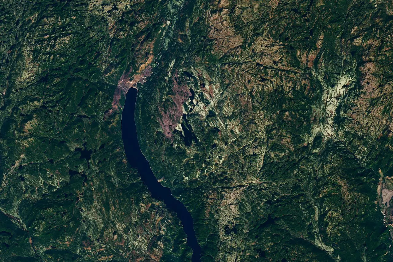
What's new
- Field expedition confirms 25-km-wide Uhackatik crater as Quebec's 11th known impact structure
- Shatter cones found in rock outcrops provide definitive field evidence of the ancient impact
- Structure named Uhackatik after consultation with the Innu Council of Ekuanitshit; formal Meteoritical Society recognition still pending
- On Sept 15, 2026, NASA's Earth Observatory chose the finding as its Image of the Day
Researchers and NASA announced in September 2026 that they had verified a crater in Quebec's remote Côte-Nord region dating back some 390 million years, a discovery that began when a hobbyist astronomer spotted a peculiar ring shape on satellite maps in 2024.156
A discovery from a laptop
Joël Lapointe, an amateur astronomer, spotted the circular feature while using satellite imagery to scout campsites for a trip to the Côte-Nord region in 2024. He reached out to scientists on both sides of the Atlantic to share what he had found.436
Separately, French researchers had already identified the Lake Marsal area as the possible centre of an impact structure at a Meteoritical Society meeting in 2024. Lapointe later said, "I encourage everyone to not ignore intuition or an observation, even if it isn't part of your field of expertise."4631
Confirming the crater in the field
Planetary geologist Gordon Osinski of Western University organised an expedition in October 2025 to investigate the site. The team travelled by floatplane and had to wade through roughly 50 metres, or about 165 feet, of water while carrying equipment to reach shore.4652
Osinski described the terrain as among the most challenging he has encountered despite fieldwork on six continents, recalling "deep, twisty, gnarly vegetation." In rock outcrops, researchers found shatter cones, which Osinski called "the only unequivocal evidence of an impact event that you can see in the field with the naked eye." The team also identified a central uplift, cliffs with columnar jointing, and breccia containing cemented fragments of broken rock.126
Rock samples indicated the impact occurred during the Devonian Period, roughly 390 million years ago, long before dinosaurs appeared.1245
Naming and recognition
Researchers settled on the name Uhackatik for the structure following talks with the Innu Council of Ekuanitshit. This marks the 11th confirmed impact site in Quebec, notable given that only around 200 such structures have been verified worldwide. The Meteoritical Society's Impact Cratering Committee has yet to grant official recognition.1254
According to Osinski and NASA, the impact occurred roughly 100 million years before a period of increased cratering on Earth linked to collisions in the asteroid belt.124
Scale and comparisons
Estimates of the crater's size vary slightly across accounts, with figures given as approximately 25 kilometres, or about 16 miles, across. Both ScienceDaily and Earth.com labeled Uhackatik the biggest crater find since Greenland's Hiawatha structure surfaced in 2018, a comparison absent from NASA's and the Dallas Express's coverage.2531
Osinski said an object capable of producing a structure of this size striking Quebec today would cause "regional devastation on a scale that would wipe out major cities and have global climate impacts."256
Not a training ground
Despite the scientific interest, Osinski does not expect Uhackatik to become a site for astronaut geology training, given the difficulty of reaching it. According to the Dallas Express, Mistastin Lake offers easier access for such training, while Inkl reported that Kameshtashtan in Labrador, which has been used for astronaut geology training, is considerably easier to reach than Uhackatik.243
Why it matters
The find illustrates how geologists believe hundreds of impact structures remain undiscovered on Earth, many potentially identifiable through careful study of satellite imagery. For readers in Europe, it is a reminder that citizen observation can still contribute to scientific discovery, and that the scale of ancient impacts offers a benchmark for assessing the potential consequences of a comparable event today.152
Version history
- version 1 ·