Climate · United States of America
California Prepares as Kelvin Wave Adds to Record El Niño Threat
As a planetary-scale Kelvin wave approaches California, Governor Gavin Newsom issued an emergency declaration, and scientists cautioned that sea levels could rise amid an unusually powerful El Niño.
A Kelvin wave, an underwater pulse of warm water tied to a strong El Niño, is nearing California, and the state has declared an emergency to prepare for possible flooding.
- Newsom declared a state of emergency on September 21
- Wave expected to reach California by early October
- Estimated sea level rise ranges from several inches to about a foot
- Officials cite the damaging 1997-1998 El Niño winter as precedent
- Highest tides of the year expected in November and December
What's new
- Newsom declared a state of emergency on September 21 ahead of the wave's arrival
- Forecasters anticipate the Kelvin wave will arrive in southern California and reach the Bay Area region around the start of October
- Estimates of sea level rise from different sources range from several inches to about a foot
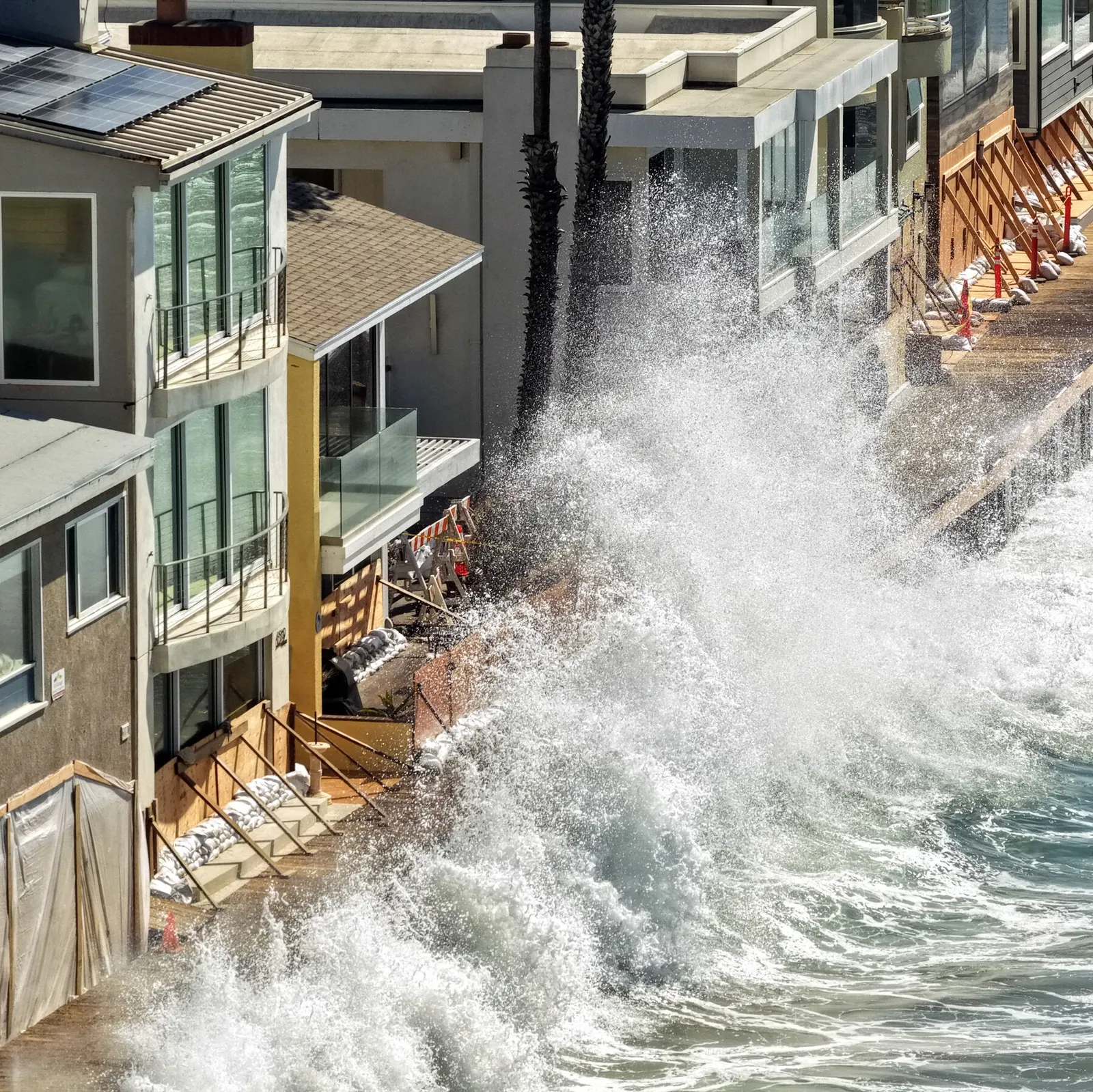
- Coastal erosion has already closed an Amtrak line in southern California
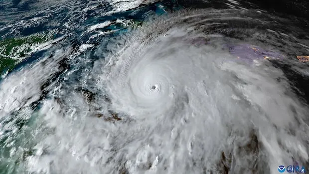
California officials began emergency preparations this week as a planetary-scale Kelvin wave, a pulse of warm water moving beneath the surface of the Pacific Ocean, advances toward the state's coastline. On September 21, Governor Gavin Newsom issued an emergency declaration to help organize the state's response as an El Niño that multiple scientists call unusually intense continues to strengthen.145
An underwater pulse
A Kelvin wave forms when trade winds across the equatorial Pacific weaken or reverse during El Niño, allowing warm water from the western Pacific to surge eastward, according to Geo News/Reuters. Meteorologist Blake Mathews explained that a Kelvin wave cannot be observed at the ocean's surface. He noted that it forms beneath the surface as a result of weakening trade winds over the Pacific's equatorial region, likening the effect to water shifting toward one end of a bathtub when pushed by a fan.56
Research oceanographer Mike Jacox of NOAA's Southwest Fisheries Science Center said this type of wave differs markedly from typical beach waves. He explained that, unlike ordinary waves, it doesn't break or become visibly noticeable as it passes, and that its primary impact is to lift the ocean's overall baseline level, essentially raising the floor beneath everything else that occurs.3
How much could sea levels rise
Estimates of the potential rise vary by source. The Guardian and Futurism reported the wave could raise California sea levels by up to a foot, a figure disputed by other outlets. AccuWeather put the possible rise at roughly one foot, while theweathernetwork.com cited a range of six inches to a foot. Geo News/Reuters described a rise of six to twelve inches lasting weeks or months, and NewsNation reported the pulse could raise levels by several inches.1345
Climate scientist Daniel Swain said in a blog post that coastal waters were already running high before the wave's arrival: "tides are already running a foot or more above average thanks to the extreme marine heatwave." According to Futurism, sea levels near Ecuador, where the wave passed earlier, were measured nearly 15 inches above average, rising to nearly 17 inches during high tide.73
A strengthening El Niño
The wave is linked to an El Niño pattern that several sources describe as record-breaking. Theweathernetwork.com reported the event has surpassed those of 2023-2024 and 2018-2019 and is strengthening faster than the 2015-2016 super El Niño. The Guardian reported that Pacific surface temperatures are now warmer than before the 1997 event, and that this year's El Niño could be the largest in at least a thousand years, though this claim rests on a single source.41
Futurism reported Pacific warm-water anomalies up to 13.5 degrees Fahrenheit above normal. The Guardian added that excess ocean warmth linked to the broader climate crisis has intensified weather events, including storms in Hawaii and Pacific hurricanes attributed to the same El Niño pattern.31
California prepares
Newsom's declaration is intended to mobilise resources ahead of the winter storm season. Caroline Thomas Jacobs, director of the Governor's Office of Emergency Services, said the state is acting before this season's storms actually arrive. She added that getting an early start on planning and resource coordination for El Niño is meant to make sure communities and first responders are equipped with the staffing, equipment, and support necessary.4
According to the Guardian, sandbags have been distributed across the Bay Area, and Marin county officials have been clearing drains and culverts and assessing infrastructure. Nick Brubaker, the county's chief resilience officer, said: "It certainly changes our baseline assumptions on how we're going to be planning for impact." Daniel Swain said early erosion has already had consequences: "Just the first few inches of elevation in southern California have already caused enough erosion to close the Amtrak line." The California Coastal Commission has urged residents to examine vulnerable sites and install drainage, with head Kate Huckelbridge among officials calling for preparedness.15
Lessons from 1997
California officials have pointed to the winter of 1997-1998, when heavy storms caused extensive coastal erosion, levees failed north of Sacramento, and 21 of the state's 58 counties were declared disaster areas, according to the Guardian. Nate Mantua, a research scientist at NOAA's Southwest Fisheries Science Center, warned the current event could exceed that damage: "it may end up causing even more damage than we've seen in major El Niño winters."1
US Geological Survey research geologist Jonathan Warrick said significant uncertainty lies ahead, noting that the approaching Kelvin wave marks only the start. He said the real concern is what unfolds during January, February, and March, comparing the uncertainty around storms and tides to a gamble.1
What lies ahead
According to the Guardian, some parts of California will see their peak annual tides during November and December, while Futurism and Geo News/Reuters reported that king tides are anticipated near Thanksgiving and Christmas. Jacox noted that unusually high tides are forecast for the Thanksgiving and Christmas period this winter. He explained that additional storms occurring at the same time would produce storm surge, and that overlapping high tides and storm surges can intensify one another's effects.135
Futurism reported that elevated sea levels could persist for months and that the World Meteorological Organization expects El Niño conditions to begin weakening by spring 2027. The San Francisco Bay Area, where critical infrastructure sits within six feet of sea level, has been identified by the Guardian as particularly exposed.31
Why it matters
Although the Kelvin wave itself is a regional Pacific phenomenon, sources link it to broader ocean warming associated with the global climate crisis. The scale of preparation under way in California illustrates how governments are responding to compounding climate and tidal risks that extend well beyond the region where the wave originates.1
Videos
Related stories
Version history
- version 1 ·